Water Report (1997)
 Our
biggest river, the Fuefuki-gawa is in the Kofu Basin. In May of 1997, the Fuefuki tested at pH 7.0.
In Summer, the alkalinity increased significantly. In June, it was pH7.5; and in
July it was 8.0. By September, the alkalinity dropped to pH7.8. We hypothesized
that the increased alkalinity was resulting from runoff from nearby farmland. Tests
in tributary rivers in Nakamichi seem to confirm our hypothesis. At a source low in
the valley, the Makadou-gawa river tested at pH 8.0 in June and pH 7.5 in July. In
contrast, a river in the mountains of Nakamichi-Minami tested at pH 7.0 (July).
Our
biggest river, the Fuefuki-gawa is in the Kofu Basin. In May of 1997, the Fuefuki tested at pH 7.0.
In Summer, the alkalinity increased significantly. In June, it was pH7.5; and in
July it was 8.0. By September, the alkalinity dropped to pH7.8. We hypothesized
that the increased alkalinity was resulting from runoff from nearby farmland. Tests
in tributary rivers in Nakamichi seem to confirm our hypothesis. At a source low in
the valley, the Makadou-gawa river tested at pH 8.0 in June and pH 7.5 in July. In
contrast, a river in the mountains of Nakamichi-Minami tested at pH 7.0 (July).
The degree of particulate matter, or (COD), in July for
the Fuefuki and Makadou rivers [7mgO/l (ppm)] was higher than
the TAKIDOU river [2mgO/l (ppm)] in the mountains of
Nakamichi-minami. If the clear-cut timber-cutting methods petroleum-based agriculture used
in this area continue, erosion could contribute toward higher (COD) levels in the near
future.
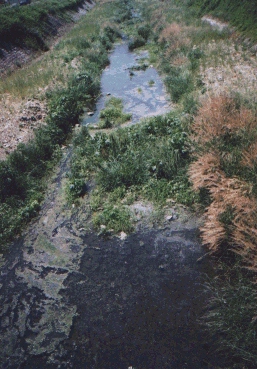
A high alkalai stream in Toyotomi-mura (July 1997)

Kofu-Basin Map | Fuefuki
River Map
Nakamichi-cho Toyotomi-mura streams map
Eco-Volunteers Index